GreenValley
Products
GVI aims to provide versatile LiDAR hardware systems to accurately map any 3D environment. Through the use of SLAM (simultaneous localization and mapping), our Handheld and Mobile systems can rapidly scan both indoor and outdoor environments without the need for GPS. This ability allows foresters, archaeologists, civil engineers, surveyors, and more to build robust datasets without prep or complex post-processing software.
  • LiAir X3C-H

    LiAir x3ch

    READ MORE
  • LiAir H800

    LiDAR H800H800 LiAir

    READ MORE
  • LIGRIP H300 UNIT ONLYproduct template
    LiGrip H300

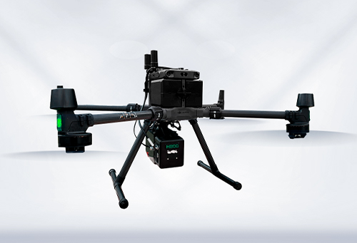
    With its advanced sensors

    Can quickly capture extensive scene data

    Scan range up to 300m

    Scan rate up to 640,000 pts/s

    With 1-inch CMOS detachable panoramic camera

    Imagery resolution can be 6528×3264

    Allows you to experience the power of multiple high-precision mapping methods

    including SLAM, PPK-SLAM, and RTK-SLAM

    Swiftly acquire point cloud data with absolute coordinates

    READ MORE